Part 1: Outbound
After months of preparation, Yoshiko and I were ready to take this advice offered by Horace Greeley over a hundred fifty years ago. The rest of the quote reads: “There is health in the country, and room away from our crowds of idlers and imbeciles.” I don’t think he was referring to anyone around us, least of all the family…
As were to discover, the “health of the country” part is certainly very true in Canada.
On 7 July, an auspiciously bright morning, we piled the last bunch of stuff and our dog Bingo into the Volvo, hitched up our RT10 trailer, and hit the road. RT10 refers to its length in feet, quite short, and its “Rugged Trailer” construction. A large part of the preparation was a search for a vehicle strong enough to survive the rough roads we expected in the northwest. Our diligence paid off.

RT10 tent trailer and navigator
Our route took us up the Ottawa River to Mattawa, then west past Lake Nipissing to Sudbury, the path followed centuries ago by the “voyageur” fur traders in their canoes. We had not reserved a campsite ahead of time, a risk because campgrounds across Canada are typically booked solid over the summer. I decided we had better see if there was anything available around Sudbury, an area I knew well from my years of working in the provincial parks. I dialed up the Ontario park service, and was directed to ‘Fairbanks Lake’, a name vaguely familiar.
“ Where are you,” I asked, “near Sudbury?”
“Yes, quite close” replied the naïf on the other end.
“On the west side?”
“Hmmm…I don’t know, I’ll have to look at a map”.
“Near the highway?”
“Yes, just off it”.
Near Sudbury, just off the highway? Ha!
Fairbanks must be a sort of penal colony for wayward park employees. We drove for half an hour west of the city to a side road leading to a derelict mine, then bounced for 22 kilometers over one of the worst roads imaginable, as the sun slowly sank. Fortunately we found the campsite, a mosquito haven for incorrigible fishermen.

Fairbanks Lake
Happily, the lake was quite pretty, our first raising of the tent, and first night in it went well. But at $58, no services, $12 reservation fee, no bargain!
Next morning we bounced back onto Highway 17 north of Lake Huron towards Sault Ste. Marie, stopping briefly at Aguasabon canyon, which empties into the lake.

On quite good roads, very little construction activity, we made good time towards our target, Wawa on the shores of Lake Superior. The terrain between the Sault and Wawa is quite rugged, typical Precambrian Shield, up and down over towering rocks: one of the really prettiest parts of a trip across Canada. We stopped at Rabbit Blanket (must have been a fur trader camp), where Bingo and I had an icy dip on a beautifully pristine beach.
 Lake Superior at Rabbit Blanket
Next, another day of rugged rocky hills north of Lake Superior, one of the most daunting parts of a cross-Canada trip, especially in winter. This road was only completed in the late 1950s, largely following the iconic CPR route cut through the wilderness in the 1880s. We had a stop in Marathon, a favorite town because in 1980 our VW van broke down there on a Canada-crossing, and we (including 2 year old Taro, no dog) had to shack up in a gas station awaiting parts from Thunder Bay
Good time on good roads once again, so we were at Kakabeka Falls outside Thunder Bay for the night. Very pleasant campground, pretty good services. Noticeably though, prices for everything in this not-so-isolated region very high.

Kakabeka Falls

Kakabeka Kamp
From Thunder Bay the road is much flatter until the hills around Lake of the Woods. We drifted through Kenora to get a taste of this famous resort area: may lakes including the huge Lake of the woods itself, lined with elaborate cottages largely owned by Winnipegers and Americans, very busy. We ploughed on over the border to the surprising lakes and forests of Whiteshell Provincial reserve on the eastern edge of the prairies. Here we stayed in the very comfortable municipal RV park on Falcon Lake ($22, full services). A very different population, mostly farm and townspeople spending their holidays with huge mobile homes and tons of ancillary stuff.

Falcon Lake RV camp
Bingo and I had a swim here too.
Around this time Yoshiko started expressing a serendipidous passion for Ukranian food. I thought we might see some roadside fast-food joints flogging perogies- but not so. This time we skirted Winnipeg on the circle bypass; I promised we would visit the city on the way back. So on the increasingly flat prairie we were soon in Saskatchewan, stopping, at just over 2500 km from home, outside Regina at a rustic private camp, the ‘Comfort Plus’ in White City. Kinda dusty place on edge of rural road, we were squeezed into the last possible site. Above ground pool closed, but there was friendly little dog park.
Next day, resuming our practice of meandering through towns on the route to get a feel for place and people, we did a quick tour of Regina, past the Parliament Bldgs, out on to plains blanketed by multi-coloured crops- wheat, canola, flax, lentils, etc. I was surprised that as we approached the Alberta border in the afternoon, the flat farmland gave way to rolling grasslands with occasional water-filled sloughs. I thought we would see some antelope but not so, only free-ranging cattle and horses.
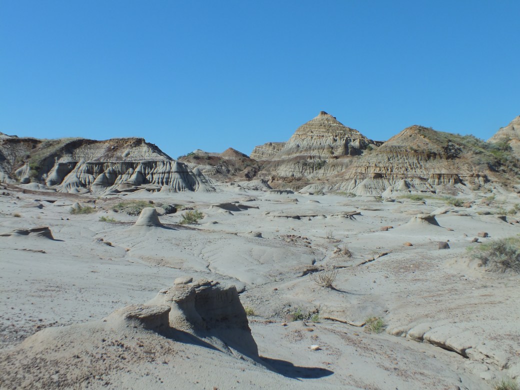
By a stroke of luck, at a pee stop in the comfortable Alberta visitor chalet at the border we discovered a second ‘dinosaur park’ on our route, just outside of Brooks. I had already been to the other one in the wild badlands near Drumheller, north of Calgary, fantastic place. Fortunately we were able to reserve a site for the night.
Incidentally, the borders Alberta and BC were the only place we encountered visitor sites. Those at east and west borders of Ontario were closed tight. No sign of them elsewhere. As well, a great paucity of signage everywhere (distances, intersections, other key info). Cutbacks? Maybe the smartphone-GPS generation does not need signs? Cost us digital-illiterates lots of backtracking.
Great discovery, Dinosaur Park. Comfortable campsites nestled in the badlands. Spectacular scenery.


Turned out the park had fossil tours, so next morning we joined a small group headed into a restricted area in one of the richest fossil sites in the world. Our guide introduced us to ‘microfossils’, minute records of some of the earliest forms of life. Some of the small kids in our group were precocious dinosaur experts, mastering the terminology and the search. Yoshiko and I did not find many microfossils, but we did find some dinosaurs remains.

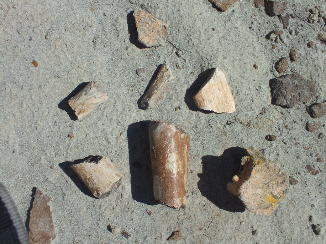
Dinosaur bones
All this time Bingo the reluctant traveler was only getting a taste of the adventure at our bi-hourly stops and in daily walks. However, when he did get to prowl about, he was a great star, guaranteed long ear-rubs and shameless idolatry. Piles of little kids at dinosaur park. One little girl, Isla’s age, rushed over to Bingo, asking if she could pet him. As she reached out to him, she stumbled and scraped her knee- so Bingo sidled over to nuzzle her. She cleared her tears and broke into song: “Old Macdonald had a dog, B-I-N-G-O was his name…”
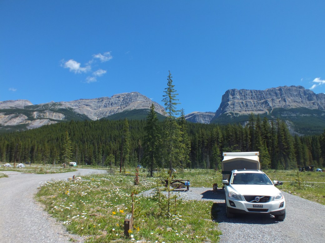
After our fossil hunt we started late for Calgary and the Rockies. Once again, we skirted the city on a circle road that went on forever. Busy traffic in early evening. Finally we were headed up the Bow River Valley towards the entry to Banff Park. There we discovered the expected: all the campsites packed solid. We were told there might be something available along the Kananaskis Trail, a whole new outdoor area developed by the Alberta government in the 1980s. In fact, a really beautiful range of mountains and foothills parallel to the Rockies, not as well known but equally impressive. Anyway, we rolled along, tens of km, seeking shelter at one camp, being told to try the next one, same result. Eventually we were told there was an ‘overflow’ area down the road. Darkness was approaching. It was actually getting chilly, storm clouds appearing. Following vague directions, we finally found the purported ‘overflow’: a parking lot at the base of a hiking trail for Elbow Pass. No one there. But there was pit toilet and a mountain stream, all we needed. Actually a beautiful site. So we raised the tent just before a light rain began.

Kananaskis camp

Later, we had violent wind and rain lashing us, and the temperature dropped to near zero C. Happily, by morning clear air and bright sun on the mountain tops. We folded camp and descended to Banff village for breakfast.
Banff is of course overrun with tourists, no longer Japanese nor Chinese but now Korean. Pervasive development. Much changed even since my last visit around 2004, hardly any sign of the small town of my first visit in 1965.
After beginning what would be a regular duty- finding a Tim Horton’s with Wifi and checking in to report progress, etc.- we spent a bit of time around the refurbished Banff train station, specifically re-affirming that local campsite were totally full- except for the Banff overflow, far up the old highway almost to Lake Louise. We headed there, past old hiking haunts at Castle Mountain and Johnston’s Creek, where we would have liked to stay. Not only were the campgrounds full, the roadsides were jammed with the cars of hikers. Not even worth stopping.
However, Banff overflow turned out to be quite pleasant: lots of space in what appears to be a clear-cut/fire zone. Maybe a back-fire site. Anyway, decent facilities, lovely view.
And wildlife! Next morning, very chilly again, no one up when Bingo and I got out to do our walk. I made the mistake of letting Bingo run free. We meandered across the largely empty campground until I looked up to see Bingo frozen in his hunting pose, eyes fixed forward. I followed his line of gaze…to a huge Elk buck, 30 meters away, returning Bingo’s interest. “No, Bingo” I shouted pointlessly as he started towards the buck. In a flash the two of them were racing through the camp, with me a distant third, still yelling. The buck and Bingo headed off into the forest, into some thick bushes. I followed and immediately plunged into an icy creek obscured by the brush. Staggering out, I imagined Bingo and buck disappearing into the wilderness. But just then Bingo came bolting back out with the buck behind. Happily, end of chase. Lesson learned by both of us.
Tellingly, a lot of campers were not prepared for inclimat weather. A Spanish-speaking group camped near us had to cover up their simple tents with tarps and don all the clothes they could find…but the fierce sun soon warmed up the day.
Later we traveled up the Bow Valley to Lake Louise. There the crowd density is such that there are warnings 10 km outside town that the parking lots at Lakes Louise and Moraine are full, so road access blocked. Apparently one has to arrive before 7am or after 4pm to find the roads open.
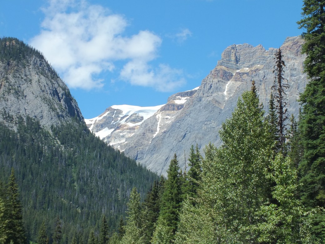
Overwhelmed, we moved on over the Kicking Horse pass to a favorite place, Field and Emerald Lake in Yoho National Park.

People everywhere, on the trails, in the gift shop, on the lakeshore, on the lake, cars parked on the roadside for half a kilometer. I was shocked to see people lined up to rent canoes at $95 and hour! We meandered through the handsome resort, where a wedding was underway. Bingo was a big hit, almost included in the wedding shots. I am sure most of the tourists were not aware that on the far side of Emerald Lake lies the famous Burgess Shale fossil grounds, the world’s foremost source of remnants of the earliest forms of life on earth.
The other local wonder is the spiral train tunnel, wherein the CPR mainline circles back on itself twice to smooth out the drop from the Kicking Horse pass to the river flats at Field. We were able to watch two trains appearing to eat their own tails while negotiating the double spiral.
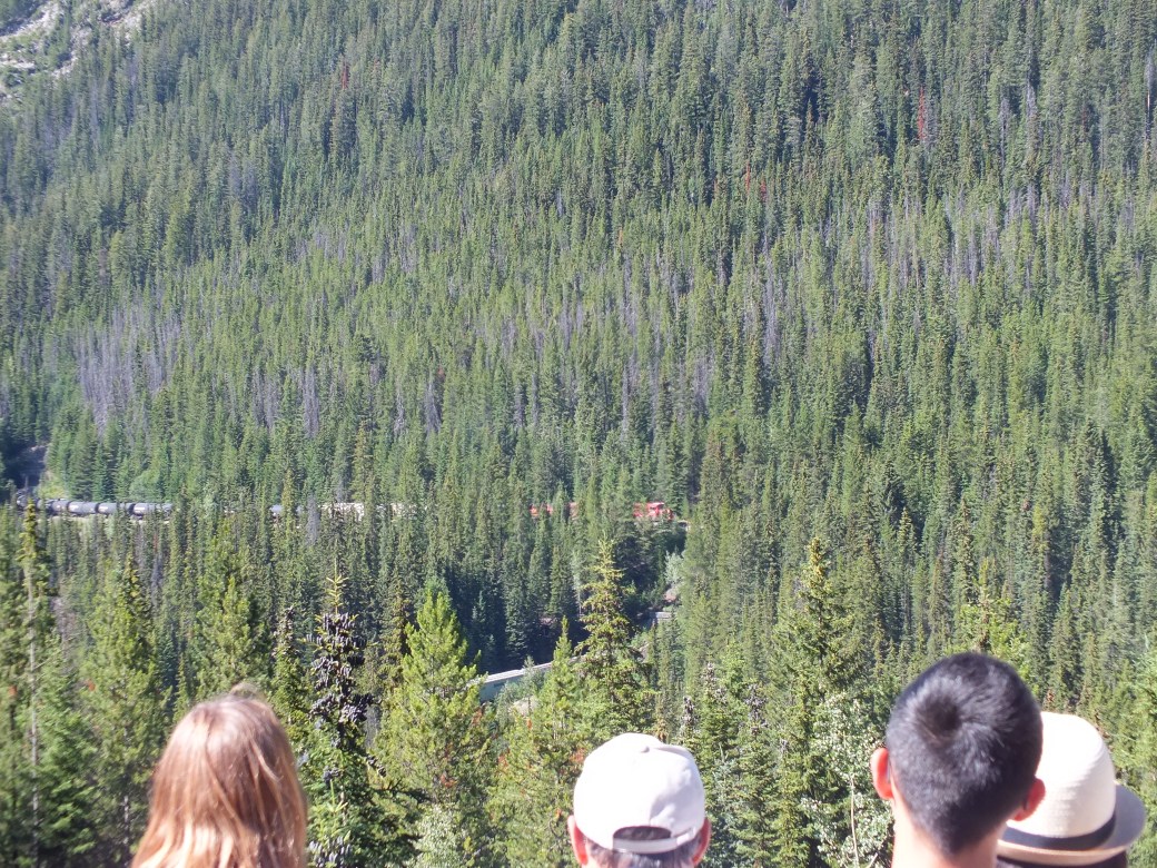 Two trains in the spiral tunnel, Yoho
Late in the afternoon we made a second assault on Lake Louise. We were fortunate to find a space in an overflow and spend some time on the Louise lakeshore.
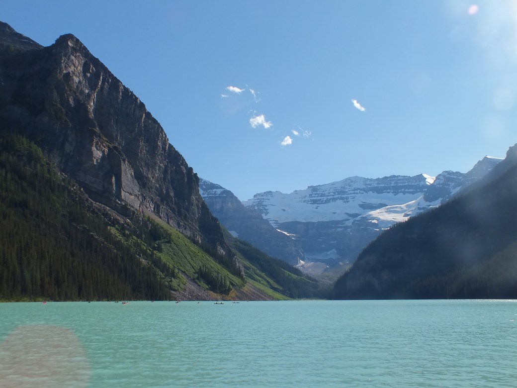

Yet more people. On the paths, in the cafes, on the lake, everywhere. Canoe rental, $110 per hour! No shortage of really loose cash…and loose screws.
Another cool night, maybe 5 or 6 C in the overflow camp. Comfortable in our little house without any heating. Bingo under control.
Next morning we set off at a leisurely pace for Jasper, taking in the sites.
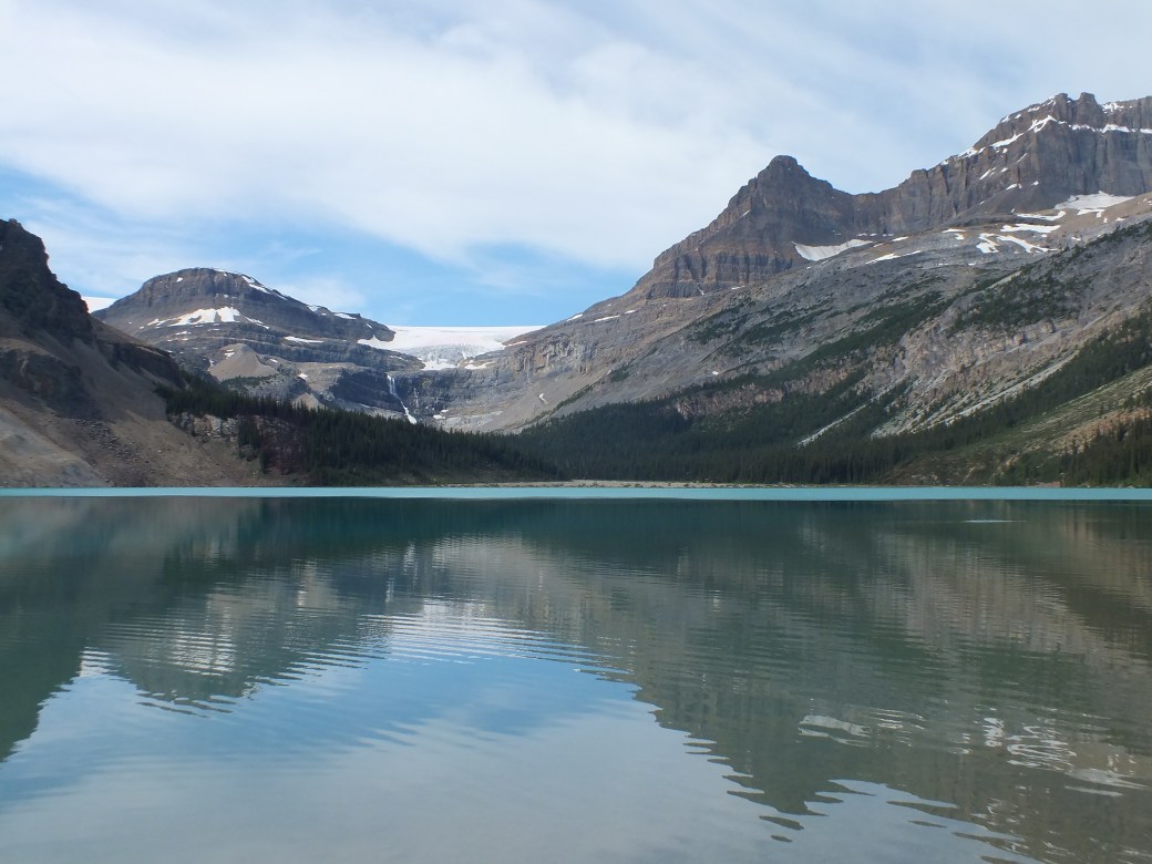


Bow Lake, Bow River Highway, wildflower, Sunwapta pass
Incomparably beautiful Bow Lake, rough rock cuts, wildlife including roadside bear, the high Sunwapta pass marking the divide between the north flowing Sunwapta and Athabasca Rivers and the south-flowing North Saskatchewan. Certainly among the most beautiful 200 kilometers of road anywhere in the world.
I had traveled the Icefield highway, between Jasper and Lake Louise, by bike in 1965, in early September when there was almost no one around except bears. Actually, I only got to Bow Lake on the bike. Heavy rains started so I joined two young guys I met, physics students from the UK, to rumble down to Banff by car.
We started from our Banff overflow camp with about a half-tank of gas, I figured more than enough to get to Jasper. However, with all the high climbs and extra weight of our trailer, I started to worry we would run short in the long stretch of no-gas road. I decided we better head to Jasper directly, and come back later to sight see, without the trailer. It got rather tense, especially over the very long and very high Sunwapta pass. In a sweat, we crept into Jasper, filled up and dropped the trailer in the Jasper overflow (everything else full, of course). The Jasper overflow is a lot more ragged than the Banff one, basically an abandoned gravel quarry between the Edmonton highway and the Athabasca River, no proper campsites, minimal facilities (a couple of pit toilets). Not even potable water. Bingo and I hiked about a kilometer to the fast flowing Athabasca to fill our jug. By morning the overflow was packed solid with campers.
Fortunately, a beautiful view.

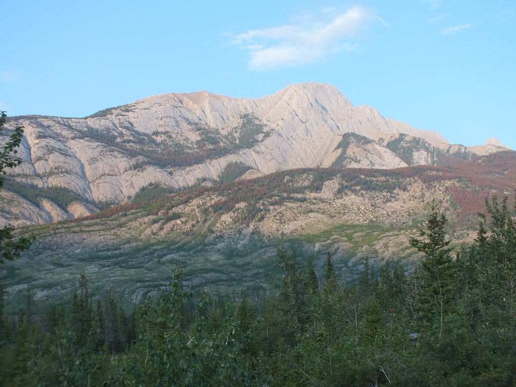
Jasper is increasingly busy with tourists, but still less overrun than Banff. It retains some of the flavour of a frontier mountain town. It is really on the edge of the great northern wilderness. In the shot above you can see the telltale red strip left by a recent wildfire that surrounded the town. I think there are still strong restraints on further development to preserve its character. I much prefer it to Banff- so we spent more time here and could not resist returning later in our trip.
We were discovering one of the really great benefits of traveling northwest in the summer: seemingly endless evenings. No longer necessary to scramble to campsite to get dinner done by dark. Typically, on this evening we resumed our exploring back on the Icefields highway up to the Athabasca Glacier.


Icefields, Athabasca Glacier
Here, another sign of change since my earlier visit: the glacier has shrunk maybe 200 meters!
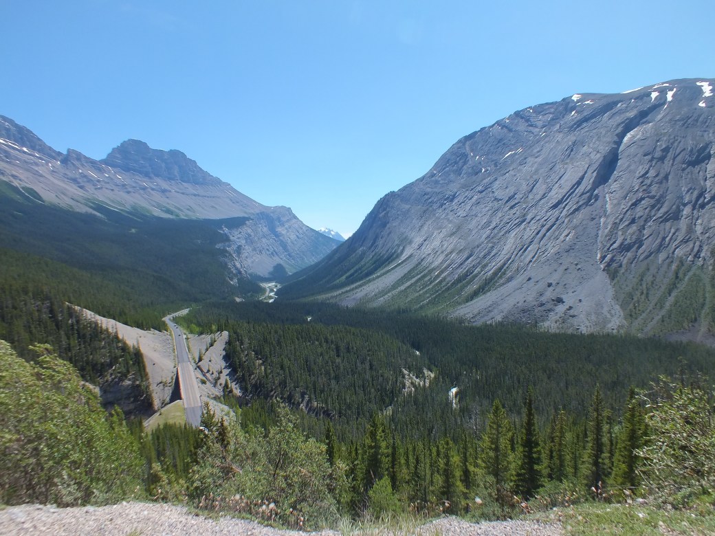
We made our way slowly back to Jasper, taking in Sunwapta Falls and its gorge, other scenery…

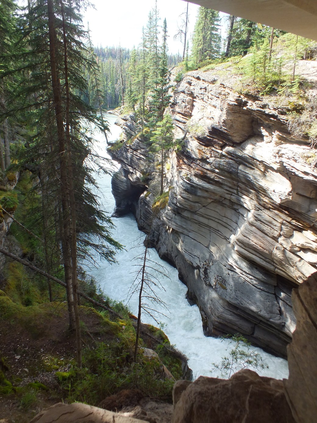
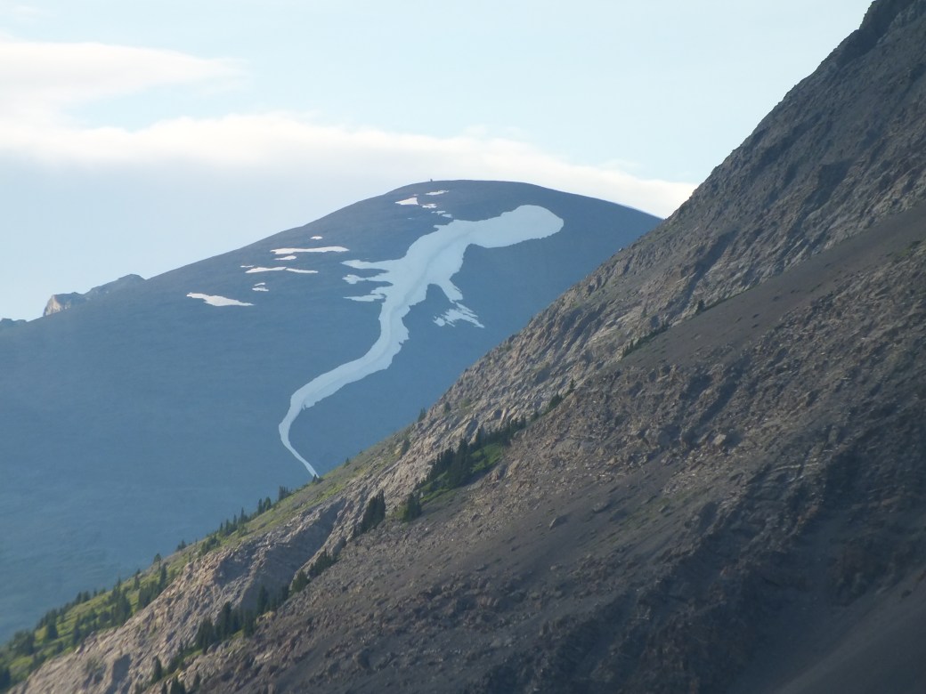
Sunwapta Falls and gorge, salamander snow
…and visiting all the small campsites along the road, for future reference. Back in Jasper around 8:30, we made another important discovery: the Dead Dog Pub Sunday night special- steak dinner for $11.95. With a cheap pint of Keith’s, a real treat!
Next morning, the start of the trek north, on the road to Prince George- Highway 97. Lunch at Mount Robson in bright sun.

Mt Robson, one of the tallest mountains in Canada
The road to Prince George, still Highway 97, follows a valley between two moderate mountain ranges. The other time I traveled here, to a conference, the fall colours of the deep deciduous forest were spectacular, significantly bright yellows instead of the red maple we see in the east. Apart from the scenery, the day’s highlight was a long shopping trip in Prince George, in a ‘Save on Foods’. Great selection, decent prices, surprisingly better than Thunder Bay in mid-Ontario. After PG, a straight road through the vast boreal forest, stretching on forever…
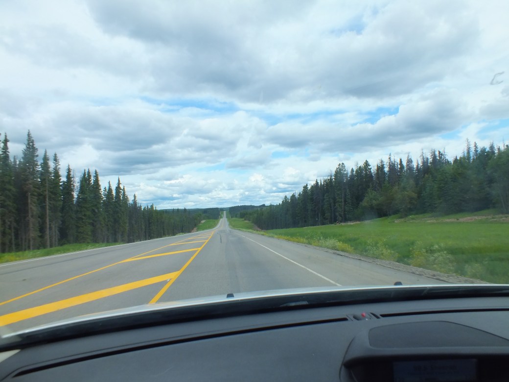
Boreal forest, stretching forward almost for ever…
Nothing on the road til we hit Halfway House.
A classic road house. Bunches of muddied heavy machinery lying around- we were in major gas drilling country- signs on the door requiring proper clothing, and removal of muddy boots. A too-friendly guard husky. Inside, lots of coffee, a table set up for a robust buffet, and a large hotpot full of stew as an alternative to coffee. Man-size toilets. We lingered with our coffee over a surprising collection of books for sale, on serious topics like local wildlife, the Rockies, butterflies etc. I got a great one on the building of the Alaska Highway. Yoshiko got a couple for kids. And only $10 each.
In late afternoon we made camp in deep bush at Whiskers Point on McLeod Lake. Swimming was pretty good among many locals enjoying the warm sun. There was a dog beach here. Me and Bingo also had a late evening hike along the shoreline of this large lake- and repose by our campfire, suddenly terminated.
Back on the road of course, headed into the Peace Country. Another interesting surprise: the Northern Rockies. Never thought about it but they continue past Jasper into the NWT- and quite spectacularly.
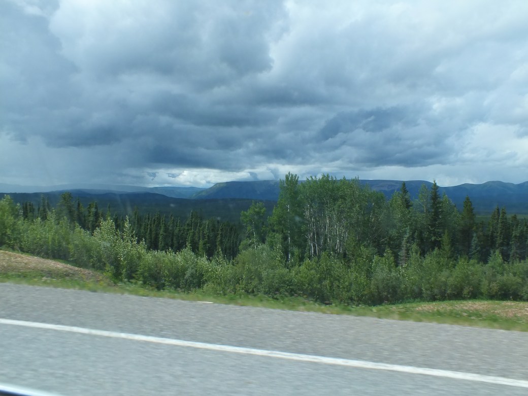

Pinepass, Peace River country
We descended into deep valleys before going over the back of this rocky ridge via Pine Pass, onto the Peace River Highway. In fact, the legendary Peace River itself started about 70 km further north, exiting the giant Williston Lake near Hudson’s Hope. Instead of heading there and onward to Fort St. John, we chose to stay on the Highway to iconic Dawson Creek. Passing through Chetwynd, we wondered at a string of elaborate Chinese-style sculptures lining both sides of the road, maybe 50 of them. Must be a story there.


Chetwynd sculpture, Dawson Creek
Yet another surprise. I always imagined Dawson Creek, frequently in news of the north, as a log outpost surrounded by impenetrable bush. Lo and behold, a modern town on the open prairie. After a mandatory stop at Canadian Tire (what greater symbol of our civilization is there?) and an ice cream shop, we headed north, at Mile Zero of the Alaska Highway. Soon we crossed the mighty Peace outside Fort St. John on the bridge that replaced a famous one moved from Tacoma after it destroyed itself in 1939- and then destroyed itself again 30 or 40 years later.

Peace River Valley
We headed for Beaton camp on the north side of Fort St. John for the night. This part of the Peace Valley was marked by huge rolling hills. We rolled up and down as darkness loomed. Did I mention lack of roadside signs these days? As we powered up to the peak of a steep slope, suddenly the pavement ended: the road continued precipitously downward in dirt ruts, almost a cliff. The guy ahead failed to stop, ending up at the bottom half a kilometer away. Just in time I braked. At my immediate left, a sign: Beaton Park.
No swimming here- grungy water filled with some sort of algae. But after dark we headed back over the hills back into Fort St. John, to the really wonderful community centre, a great pool, hot tub and water slide among the facilities. For a couple of bucks we had a relaxing swim. This kind of centre turned out to be a common feature in the smaller northern towns. And another common feature, really friendly people.
Next day we did the next ‘250 miles’ of the Alaska Highway, through a lot of gas drilling sites and really minor gas stops to Fort Nelson. We had left the Peace River valley, running east of the Rockies in rolling foothills.
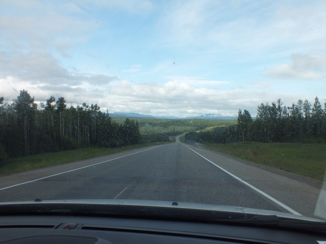
Alaska Highway north of Dawson Creek

Fort Nelson camp

Fort Nelson was pretty much like Dawson and St. John, modern little towns. We were getting grubby so we opted for the ‘Triple G Hideaway RV Park’, which offered a Laundromat. I think the ‘G’s stood for George, Gloria, and Gaston or something like that. We were lucky to get a place in this sea of gigantic road barges. In fact we had to fit in between two touring caravans of 20-30 of these RV beasts full of Elderhostel-type retirees from all over North America. The camp had a big restaurant featuring a substantial buffet dinner each night. We did not indulge.
On local advice we signed up for two nights so we could do a day trip 300km further up the Alaska Highway towards the Yukon to visit the Liard River hotsprings. Wise move. Fantastic scenery, once again in the northern Rockies, even more rugged high peaks, sharp rock cuts, tight switch backs, rushing streams and big lakes.


Northern Rockies
Summit Lake
Northern Rockies Lodge

Local residents
Without the trailer, driving the switch backs was real fun, especially as the co-pilot was asleep. Lots of wildlife though, kept the watchdog alert. We made good time, got to the springs by noon.


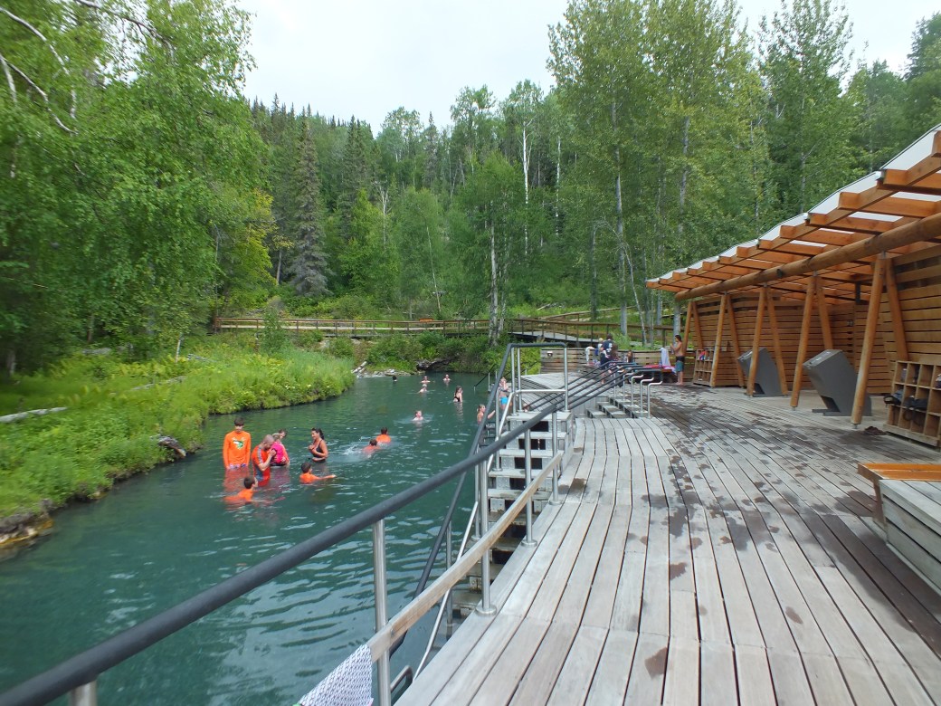
Another revelation! The Liard River is historically important, but never heard of the Liard River Hotsprings. A Provincial Park, free for the public, very simple but very comfortable access to quite hot sulphurous springs ‘discovered’ by workers building the Alaska Highway in the 1940s (probably already known to natives). We had a delightful soak before heading back to Nelson in the late afternoon.
North of Nelson we left the Alaska Highway (still #97) for the Liard Highway towards the Territories. More endless boreal forest. Decent road surface til we got to the NWT border. Gravel! For 40 km. Mostly loose, dry and dusty. Almost no traffic, just the odd truck or camper. Winding trail through mixed forest and rocky outcrops. We were counting on gas at Fort Liard, so we were relieved to finally hit a bit of pavement on the edge of a modest indigenous community of clapboard homes. No real gas station, but a depot of large tanks with a single nozzle and attached card reader. Simple but effective. Turns out the indigenous Band communities manage these sorts of facilities as a collective. This one was open to non-members (apparently!). Good thing- only gas anywhere.
More gravel on NWT Highway 7, about 100km to Blackstone Camp, our first visit to a Territories park. The NWT road map gives a visitor a good feel for the scale of things in these parts. My map is about 3 feet square. The bottom 4 inches easily contains all the passable roads!

Highway 7, NWT

Up #7 towards the Liard River and Blackstone campsite
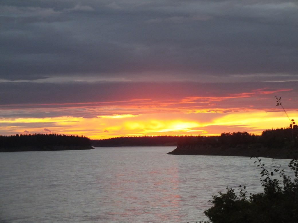
I quite liked Blackstone. On the banks of the Liard River, directly across from Nahanni Butte in the lower Yukon, maybe 20 rustic sites, heavily forested. Excellent facilities, including charming museum. The Territories have made a huge effort to encourage tourism with a string of well-equipped camps. We were introduced to a prominent feature: charming women in charge throughout. There were bugs of course, more manageable mosquitos rather than blackflies. Bingo and I had a long hike by the river; I had a brief swim in the silty Liard, dragged fiercely downriver by the current.


Nahanni butte, sunset on the Liard River
But our first disappointment- we could not get across the river to the Yukon, accessible only by air. If I had known, we would have continued past the Liard Springs to Watson Lake and maybe even Whitehorse. What’s another 1000km. Next time.
More gravel, another 200km to Fort Simpson, where there was a deceptive stretch of pavement. We had to cross the Liard on a basic ferry, the Lafferty.


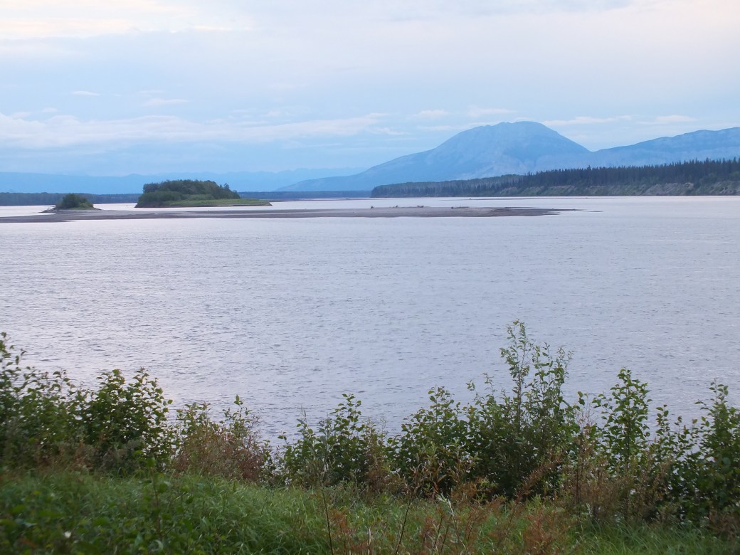
Fort Simpson where the Liard joins the Mackenzie…

…is the stepping stone to the famous Nahanni River wilderness and much of the western hinterland. It is also the starting point of the Mackenzie Highway that runs about 200km down that river, then yields to winter road that runs another few hundred km to Norman Wells and Great Bear Lake. Far out, literally!
In the Nahanni hotel we had a decent fish and chips and fried chicken before going back to rejoin the highway, now NWT #1.

More gravel! Another 250 km to Fort Providence. Sometimes loose and dry. Sometimes muddied by light rain. Sometimes one continuous pothole. Fortunately little traffic to scatter up stones. Maybe not so fortunately, our gas mileage was below expectations. And gas stations marked by road signs turned out to be phantoms. Theoretically we had enough to reach Providence, according to my ‘km to empty tank’ display. I was watching it carefully and trying to match its readings to the sparse mileage signs on the road. Did not look good. I considered leaving the trailer to go for gas. But we persevered, in a sweat. Last 45 km paved, so mileage better. Up one side of the magnificent bridge over the Mackenzie…

I was counting on coasting on the downslope…but no, a red light protecting non-existent construction workers. I ran it and coasted a bit. Last few km, running on fumes, a Shell logo in sight, there at last.
What’s this? Gas pumps all covered in plastic bags. As I tried to work one, a local comes out; “we ran out of gas an hour ago”
“Jeez”
“Try that Band pump over there”
Wheeeuw. Not only our saviour but 14 cents cheaper than the $1.56 at the Shell.
That night we spent in the open poplar forest of the Fort Providence camp, on a high cliff along the Mackenzie River shore.
Here again, pretty good facilities- but suspended in seemingly stalled repair; and a local woman manager, charming but seemingly not in total control.
Full of gas, next day we headed for Yellowknife, 300 km up a very straight, lonely Highway 3. Largely a very good surface through a huge buffalo reserve. Not much traffic: everyone was in Yellowknife for its annual folk music festival which was winding up as we arrived. In fact, it looked like all of Yellowknife had been wound up. Empty streets except for homeless stragglers. Apparently the city shuts down on Sunday. Almost nothing open. A lot of permanently shuttered stores
I did find a really good bookstore, shortly before it closed for the day, while Yoshiko was scurrying about the streets trying to find a public toilet…
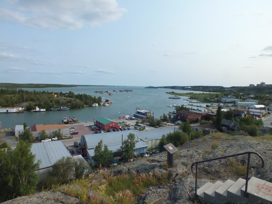
This night it was the ‘Fred Henne’ camp, close to downtown, on a rather rocky outcrop adjacent to the site where gold was first found and became Yellowknife’s raison d’etre. Bingo and I hiked over the mine site that evening, the sun still refusing to go down at 10pm.
Yellowknife is pretty much a rock on the water, the rock providing its wealth, the water the means of gathering it. Still has the air of a frontier outpost.


Yoshiko’s desperate search for relief had another positive result- she ran across a liquidation centre full of interesting stuff, not just another of her thrift shops she assured me. Sure enough, a depanneur-sized store in a semi-derelict mall packed with esoteric machinery and mechanical bits and boots and clothes and CDs and just about everything else, including a jolly rotund liquidator happy to demonstrate his wares. We had a great time poring through the piles. Eventually I asked if he had any CDs with local fiddle music (a talent in these parts). He said he’d look. After a while an odd assistant- looked like an Afghan refugee- brought me a CD by a Fort Simpson musician. $1. Then the liquidator found another by a local band.
“Here, it’s yours” he said.
“No charge?” I said, “At this rate you’re going to go out of business”.
“That’s the plan” he replied…
A highlight in an otherwise disappointing town. To be fair, our visit was short, on a Sunday. With more time we could have explored the long string of remote camps on the Ingraham Trail north of town, to the edge of the winter road that leads another few hundred km north to the diamond mines.
More gas, about $1.45 litre here, then back down the road, over the Mackenzie to Hay River, to the Hay River camp at the edge of town, on Great Slave Lake. Really great camp nestled in the mixed bush, excellent facilities, run by a pair of charming and very competent women. A favorite stop.
Until the roads came to the north in the late 1960s and 70s, Hay River was the end of the line, the railhead where food, machinery, building materials, everything, was transferred to barges for a trip across the lake to Yellowknife or down the Mackenzie to the Arctic Ocean. From our camp the lake looked like an ocean. Next to the beach, several large lake boats reposed in retirement.
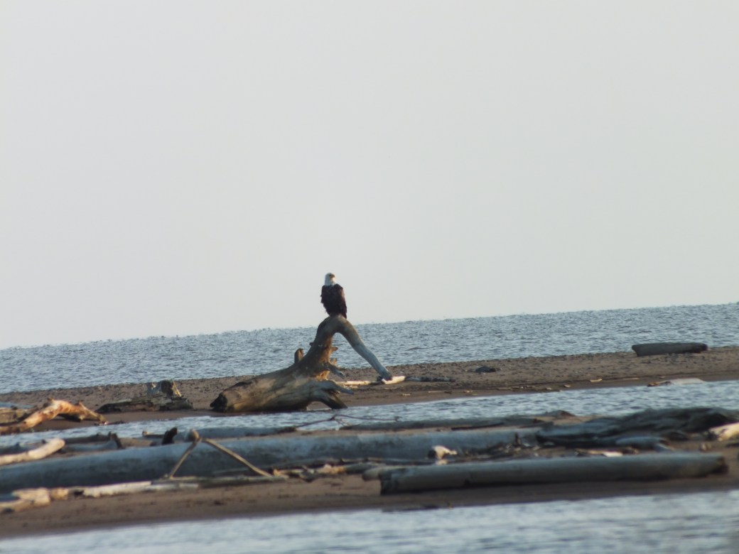
Great Slave Lake with ornamental eagle
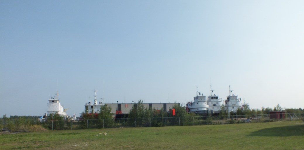
Retired Northern Transportation workers
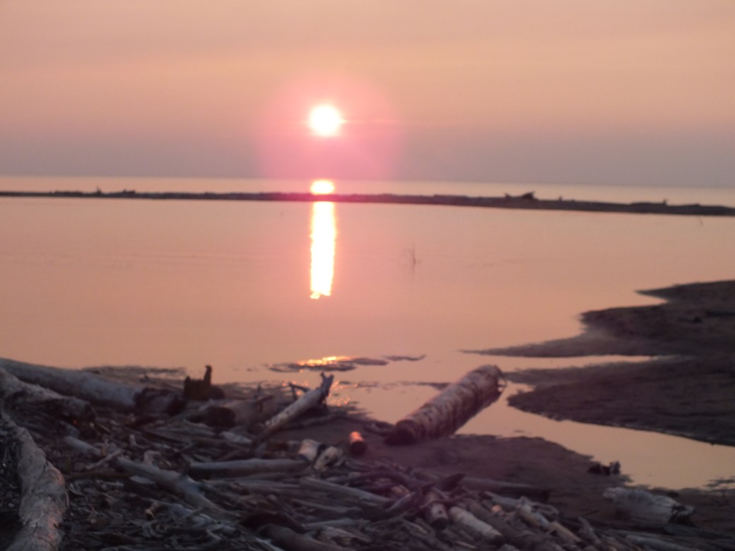
Great Slave sunset
I had a swim in pretty clear water, not as cold as Lake Superior. In the evening we discovered the dining room at the Ptarmigan Hotel, minutes before the kitchen closed. Fine crispy calmari, excellent whitefish and tuna steak, prices quite reasonable.
Another long, straight, lonely road, Highway 5 to Fort Smith. This was one of the roads I worked on as a summer job in 1963 and 65. At that time the contractor was preparing a basic road bed, a lot of clay with a gravel topping, through near-virgin forest. We were only about 30 miles out of Fort Smith. About the same time the NWT government cut a winter road (over frozen muskeg and rivers) to Hay River to bring in a dismantled sawmill for Claire Lake, south of Fort Smith. Otherwise, until the 1970s everything had to be brought in by air, or barge from the Peace River.
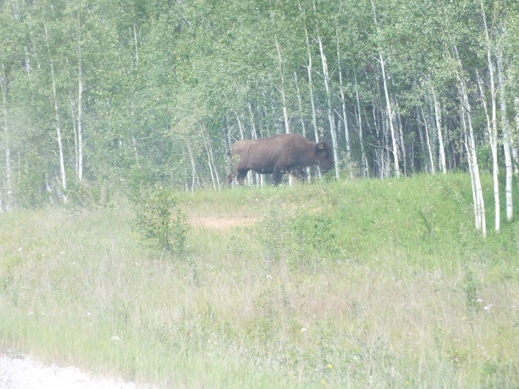
Now there was a fine road surfaced with pulverized granite, very durable. Not much traffic but not entirely empty: lots of buffalo. Almost all the 200 km are in Wood Buffalo National Park, a giant reserve where these magnificent beasts have been revived.
 Local resident
We arrived in Fort Smith in good time to set up camp at Queen Elizabeth park, in a tall pine stand on the edge of town, and the bank of the Slave River.
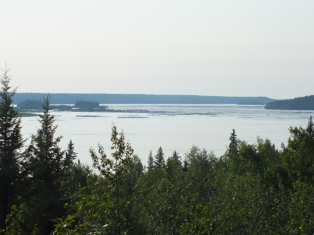 Slave River
Another great camp, in the form of a Band pow wow centre. Excellent facilities and a really interesting manager, with a neat name like ‘Butterfly’ or somesuch. I told her about working on the roads so we got into a great discussion about people and places I might have known. She told me about a book she had, written by Harold Steed, the roads superintendent at the time, which she brought in for me the next day. Subsequently I obtained a copy from an out-of-print book dealer (along with several gems about the history of Rockies pioneers, and a biography of an itinerant opthalmologist I happened to meet during my stay in 1963).
Steeds’ book is an enthralling account of the building of roads and other development projects in the 1950s and 60s, with minimal resources but a lot of fortitude and hard work. Latter-day pioneers; and I was there!
Fort Smith does not look a lot different than what I remember. Some new stores, the hotel where my drinking career began now a hole for a new project, the Chinese restaurant gone, a museum indicating residents now have the luxury to reflect on their place in time.
As for my place in this time, we did a trip down 50km of gravel towards Peace Point of the Peace River. This is the road I first worked on, in 1963, as part of the survey crew monitoring a lusty big Alaskan entrepreneur trying to make a killing on a cost-plus contract. He was forever hauling in new machines and new workers to overcome one problem or another. Our camp was about 50 miles out, so we rarely got into town. When we did, we were invariably plied by the contractor over a table full of beer…
Our camp would now be totally overgrown. We did not go that far, instead visited Fort Fitzgerald, where bargeloads from the Peace River would be unloaded for transit by truck around the rapids, to be put back on barges on the other side of Smith. And we wandered down a bush trail to look for Pelicans at Pelican Rapids on the Slave River. Surprisingly, this is a major breeding area for pelicans.
 Pelican rapids on the Slave River. No pelicans visible…
The road looked pretty much like it did 53 years ago, modest gravel surface, thick poplar and birch bush on both sides. Maybe better gravel, less red clay and there was even a grader working the road.
 Pine Lake Road
Another feature remained the same- the main residents!


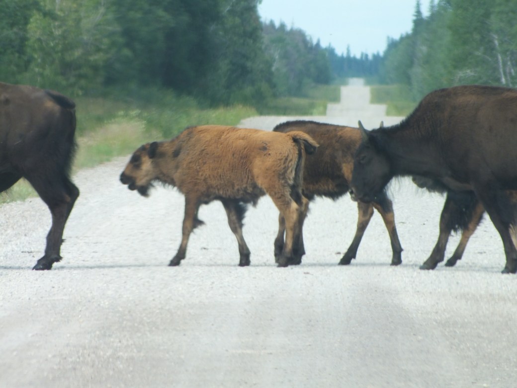
Magnificent Wood Buffalo meandered casually about the roadway, happy to escape the flies in the bush. This was one of several families we encountered. High point for Bingo: he went completely ballistic, shrieking in his hunting voice with his nose to the windshield. He should be happy there was a windshield between him and these guys…
We turned off the highway on the road to Pine Lake, a place of really fond memories. Once or twice in ‘63 me and my buddy Jack Cameron got to the lake in the heat of summer, on one occasion for some sort of giant party, maybe Canada day. Anyway, there was lots of music and dancing and lovely local girls. In the end we just flaked out on the beach, awakening in the morning sun for a swim in the pristine waters. Heaven!
Though it was hard to find anything resembling my memories of the beach in the current rather ragged scene, I had to memorialize the past in a ritual end to the outbound leg of our pilgrimage.

Pine Lake Memorialized

What a trip! Great chronicling. I remember having having fish and chips in Yellowknife for 2 with a beer each for about $125. May have sent this to you before but here is a video I made of a canoe trip down the Nahanni – float plane launch point in Fort Simpson and take out point in Nahanni Butte – both of which you visited.
Thanks for sharing!
LikeLike